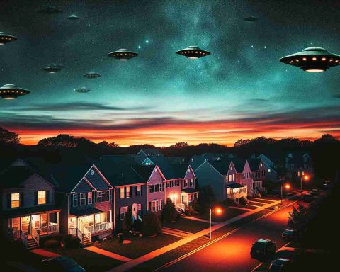
Unusual cloud formations are captivating observers across the northern UK. The phenomenon has sparked intrigue among residents and sky-watchers, with many noting these striking formations resemble iconic flying saucers.
These impressive displays, known as lenticular clouds, have garnered attention for their unique lens-like shape, a term derived from a Latin word meaning “lens-like.” Earlier this week, they appeared prominently over regions including Gateshead, Newcastle, Cumbria, and Scotland, creating a breathtaking sight.
The Met Office explains that lenticular clouds form in stable air conditions as winds encounter mountains or hills, setting off a series of waves in the atmosphere, akin to ripples in a river. When moist air rises due to these waves, condensation occurs, leading to the formation of these fascinating clouds.
There are three primary types of lenticular clouds: altocumulus standing lenticular, stratocumulus standing lenticular, and cirrocumulus standing lenticular, each varying in elevation. These clouds not only serve as visual marvels but also indicate significant mountain wave activity within the atmosphere, which can lead to gusty winds in nearby areas.
Interestingly, while pilots of powered aircraft generally steer clear of these clouds due to associated turbulence, experienced glider pilots take advantage of their presence to locate rising air currents. As these mesmerizing formations continue to dazzle visitors, they remain an extraordinary feature of the UK sky.
Beyond the Clouds: The Cultural and Environmental Impacts of Lenticular Formations
As lenticular clouds drift elegantly across the northern UK skyline, they evoke not only awe and fascination but also significant cultural and environmental implications. The captivating displays have ignited the imagination of local artists, photographers, and writers, inspiring a newfound appreciation for the natural world. Cultural phenomena such as these remind us of humanity’s deep connection to the environment, urging society to embrace a more profound respect for atmospheric science and natural beauty.
On a broader scale, the increase in unusual meteorological phenomena, like lenticular clouds, reflects crucial changes within our climate system. The emergence of more dynamic weather patterns due to global warming—evident in extreme weather events—could lead to heightened occurrences of such formations. These clouds serve as indicators of shifting weather patterns, subtly warning of the increasing turbulence in our atmosphere that may influence flight safety and agricultural planning.
Economically, regions heralded for their striking cloud formations often see a boost in tourism, drawing enthusiasts eager to witness nature’s artistry. Such interest can invigorate local economies, simultaneously promoting environmental awareness and stewardship.
As we gaze up at these lens-like wonders, we must consider their long-term significance—not merely as fleeting spectacles but as reflections of the broader changes occurring within our climate, nudging society toward adaptation and resilience in the face of environmental challenges.
Mesmerizing Lenticular Clouds: Nature’s Alien Artistry Graces the UK Skies
The Enigmatic World of Lenticular Clouds
Recently, the skies across northern UK have been adorned with remarkable lenticular clouds that resemble UFOs, igniting curiosity among residents and sky-watchers alike. These striking formations are not just visually captivating; they also hold fascinating insights into atmospheric phenomena.
Characteristics of Lenticular Clouds
Lenticular clouds, characterized by their lens-like appearance, form in stable atmospheric conditions. When moist air rises and encounters geographical features like mountains or hills, it creates a series of atmospheric waves similar to ripples in water. As this air cools, condensation enables the distinctive cloud formations to emerge. The Met Office has detailed that these clouds are often precursors to mountain wave activity, which can generate significant winds.
Types of Lenticular Clouds
There are three primary classifications of lenticular clouds based on their altitude:
– Altocumulus Standing Lenticular: Typically found at mid-range elevations, these clouds present a soft, rounded appearance.
– Stratocumulus Standing Lenticular: These clouds are lower in the atmosphere and often appear flatter.
– Cirrocumulus Standing Lenticular: Found at high altitudes, these clouds display a more delicate and wispy characteristic.
Each type serves as an indicator of the atmospheric conditions nearby, particularly related to turbulence and wind patterns.
Pros and Cons of Lenticular Clouds
Pros:
– Weather Indicators: Their presence can inform meteorologists about impending weather changes.
– Aviation Benefits: Experienced glider pilots use these clouds to locate rising air currents, enhancing their flying experience.
Cons:
– Turbulence Risk: Powered aircraft pilots typically avoid these formations due to the turbulence they often cause.
Observations and Impact on Daily Life
The recent appearances of these clouds over regions such as Gateshead, Newcastle, Cumbria, and Scotland have stirred a wave of interest. Communities are encouraged to embrace local meteorological events, enhancing both education and engagement with nature.
Expert Insights and Predictions
Meteorologists continue to study lenticular clouds to better understand their formation and implications for weather patterns. As climate science evolves, predictions regarding their prevalence and characteristics may become clearer, offering insights into broader atmospheric changes.
Fun Fact
Did you know that lenticular clouds are often mistaken for UFOs due to their unique shapes? This has led to increased attention from both amateur and professional astronomers!
Conclusion
Lenticular clouds are not just a visual wonder but also a gateway to understanding the complexities of our atmosphere. As these clouds continue to grace UK skies, they remind us of the intricate and beautiful systems at play in our weather. For more intriguing weather phenomena, visit Met Office.


