The Alarming Reality of Greenland’s Ice Loss
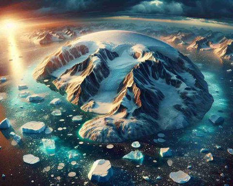
The vast ice sheet covering Greenland, essential to Earth’s climate stability, is disappearing at an unprecedented rate, which has raised serious concerns among scientists and global leaders. For the first time, experts can track this alarming ice melt in real-time, thanks to an innovative partnership between two powerful satellite missions: ESA’s CryoSat and NASA’s ICESat-2.
These advanced satellites utilize state-of-the-art radar and laser technologies to provide the most accurate data regarding the diminishing ice. By integrating their findings, researchers can now observe changes in ice thickness and volume more precisely than ever before. This notable collaboration offers invaluable insights regarding the melting ice sheet and its significant effects on global sea levels and ecosystems.
Recent data reveals a grim trend: between 2010 and 2023, Greenland’s ice thickness shrank by an alarming average of four feet. Notably, the Jakobshavn Glacier has experienced reductions of up to 220 feet, while the Zachariae Isstrøm Glacier has lost approximately 250 feet.
This drastic ice loss has widespread implications. It contributes to rising sea levels, alters weather patterns, and poses threats to Arctic wildlife, including polar bears and seals. The local communities that depend on stable ice for their livelihoods are also facing significant challenges.
The precise measurements from CryoSat and ICESat-2 are critical for aiding scientists and policymakers in making informed decisions to combat climate change effectively. The time to act is now, as the impacts of this melting crisis resonate worldwide.
Greenland’s Ice Melting Crisis: What You Need to Know
The Alarming Reality of Greenland’s Ice Loss
Greenland’s vast ice sheet, crucial for regulating global climate patterns, is facing an unprecedented rate of melting. This dramatic decline poses serious concerns for scientists and global leaders alike. Recent innovation in satellite technology has amplified our understanding of this crisis; a collaboration between ESA’s CryoSat and NASA’s ICESat-2 has enabled researchers to monitor ice loss in real-time with remarkable precision.
# Innovative Technologies for Ice Monitoring
The integration of radar and laser technologies from CryoSat and ICESat-2 has revolutionized how we track changes in ice thickness and volume. This synergistic approach allows for near-instantaneous data collection and reporting, thus improving the accuracy of ice loss assessments and offering unprecedented insights into how these changes affect global sea levels and ecological systems.
# Climate and Ecological Impacts
The consequences of Greenland’s ice loss are far-reaching. Between 2010 and 2023, it is reported that the average ice thickness reduced by about four feet, with specific glaciers, like Jakobshavn and Zachariae Isstrøm, exhibiting retreat rates of up to 220 and 250 feet, respectively. This substantial reduction contributes significantly to rising sea levels, which threaten coastal areas worldwide.
Furthermore, changes in the ice sheet impact weather patterns and endanger Arctic wildlife, including species such as polar bears and seals that rely on stable ice for their habitat. Indigenous communities dependent on these ice formations are also facing challenges to their traditional ways of life, intensifying the need for urgent action.
# Future Monitoring and Proactive Measures
The data collected from these cutting-edge satellite missions is instrumental for scientists and policymakers. With accurate measurements, they can develop effective strategies to combat climate change and mitigate its impacts.
# Pro and Cons of Increased Surveillance
Pros:
– Real-time data: Immediate availability of information helps in timely responses.
– Precision: Enhanced accuracy in measuring ice loss allows for better predictive models.
– Policy formulation: Data-driven insights are crucial for climate negotiations and environmental protection strategies.
Cons:
– Resource-intensive: Continuous monitoring comes with high operational costs.
– Technological limitations: Dependence on satellite technology may overlook localized environmental changes.
# Trends and Future Predictions
As climate change continues to accelerate, experts predict that Greenland’s ice loss will not only persist but could also intensify. Future studies utilizing improved satellite technology are expected to provide even deeper insights into these trends, essential for preparing societies for the inevitable effects of rising sea levels.
# Conclusion
Addressing Greenland’s ice melting crisis is critical not just for the Arctic but for the entire planet. Continued innovations in satellite monitoring and research will play pivotal roles in our understanding and response to climate change.
For more detailed insights on climate change and related technologies, visit NASA or ESA.


