India’s regional satellite navigation system, known as NavIC, is set to revolutionize the way we navigate our world. This innovative technology offers precise positioning, velocity, and timing data to users across India and extends its reach up to 1,500 kilometers beyond its borders.
The latest addition to this system, satellite NVS-02, is poised to enhance overall performance significantly. With this upgrade, a variety of applications stand to benefit, from navigation services utilized by everyday drivers to agricultural practices that rely on pinpoint accuracy for effective farming. Fleet management will also see improvements, ensuring that transport services can operate more efficiently.
Moreover, emergency services will gain an edge, with faster response times thanks to accurate location information. The introduction of mobile location services will further elevate the user experience, making it easier for individuals to access precise navigation tools right from their smartphones.
As the NavIC system continues to advance, it promises to make a lasting impact on various sectors, boosting convenience and efficiency across the board. Stay tuned for the ways this cutting-edge satellite navigation technology transforms daily life in India and beyond.
The Broader Impact of NavIC: A New Era in Navigation
As India’s NavIC satellite navigation system evolves, its implications on society, culture, and the global economy are noteworthy. This innovative technology not only enhances everyday navigation but could reshape economic infrastructures. By providing precise positioning data, industries ranging from logistics to tourism can experience increased efficiency and productivity. For instance, accurate geo-location can facilitate better route planning and resource management, potentially resulting in significant cost savings and improved service delivery.
The cultural effects may also be profound. By democratizing access to high-quality navigation tools, NavIC empowers local businesses and individuals, enabling them to compete on a more level playing field. This could help foster a sense of ownership over one’s navigation solutions, as Indian-designed technology surpasses reliance on foreign systems like GPS.
From an environmental perspective, the potential for sustainable practices is immense. NavIC could optimize agricultural operations, contributing to better resource management and reduced waste through precision farming techniques. Future trends may also lead to innovations in autonomous vehicle navigation, making transportation safer and less polluting.
Overall, the long-term significance of the NavIC system is monumental, positioning India as a global leader in satellite navigation technology and ushering in a profound transformation in societal operations and economic models.
Transforming Navigation: How NavIC is Changing the Landscape of Positioning Technology
India’s regional satellite navigation system, NavIC (Navigation with Indian Constellation), is on the brink of a significant transformation in how navigation services operate within the country and beyond. With the recent launch of satellite NVS-02, NavIC is set to bolster its performance capabilities, enhancing accuracy and expanding its application across various sectors.
Key Features of NavIC
NavIC boasts several innovative features that make it a formidable player in the world of satellite navigation:
1. High Precision: Offering location accuracy within a range of 20 meters, NavIC provides precise positioning data, which is essential for both personal and commercial uses.
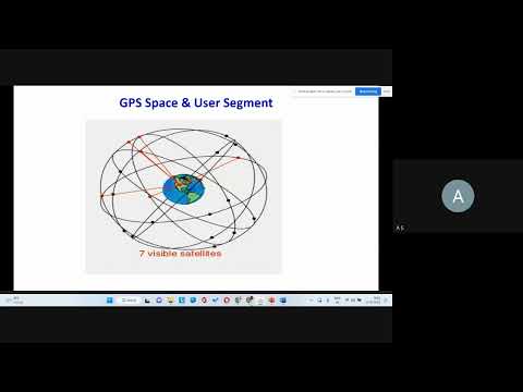
2. Extended Coverage: While primarily serving users in India, NavIC can provide services up to 1,500 kilometers outside its borders, making it useful for neighboring countries as well.
3. Versatile Applications: NavIC’s services extend beyond personal navigation; they are highly beneficial for industries such as agriculture, transportation, disaster management, and more.
Use Cases of NavIC
The diverse applications of NavIC are significant for improving efficiency and effectiveness in several fields:
– Agriculture: Farmers can use NavIC for precision farming, improving crop yields by utilizing data for soil management, irrigation, and harvesting.
– Transportation and Fleet Management: Transport companies can enhance routing efficiencies and monitor vehicle performance with real-time data from NavIC, reducing operational costs.
– Emergency Services: Faster response times in emergencies are achievable with NavIC’s accurate location tracking, enabling quicker coordination and deployment of services.
– Personal Navigation: With enhanced mobile location services, individuals can access NavIC through their smartphones, benefiting from real-time navigation assistance.
Security Aspects
The deployment of NavIC also comes with significant security considerations. As it operates independently of global positioning systems like GPS, it offers a reliable alternative, free from potential geopolitical risks. This self-reliance is crucial for national security and disaster management, providing uninterrupted services even in critical situations.
Trends and Predictions
As NavIC continues to evolve, projections indicate increasing adoption across various sectors. Technology advancements, such as the integration of NavIC with emerging technologies like IoT (Internet of Things) and AI (Artificial Intelligence), will likely amplify its impact. Innovations in satellite technology can also enhance the responsiveness and capabilities of the navigation services provided.
The rise of smart agriculture and automated vehicles may further drive the demand for precise navigation solutions, keeping NavIC at the forefront as a preferred navigation choice in India and the surrounding regions.
Limitations of NavIC
Despite its promise, NavIC does face limitations:
– Limited Global Reach: Unlike GPS, which has worldwide coverage, NavIC’s performance diminishes outside its intended service area.
– Initial Costs: Implementing systems that incorporate NavIC technology may require significant investments from businesses looking to upgrade their operations.
Conclusion
With the launch of satellite NVS-02 and ongoing advancements in technology, India’s NavIC is poised to greatly influence the future of navigation, enhancing daily experiences and boosting efficiency across sectors. As its implementation progresses, users can expect a reliable, precise navigation system that meets modern demands.
For more information about NavIC and its features, visit ISRO.